GPS Camera 55
GPS Camera 55 helps you capture photos stamped with location, direction, time, notes, and other field data directly on iPhone and iPad.
It is especially useful if you need to:
- document site work, inspections, trips, or evidence with location-stamped photos
- record, replay, and export location-aware video with data overlays
- add notes, direction, altitude, and custom overlays to each image
- export photos and points to PDF, KMZ, KML, or shareable reports
- keep field photos organized for later review, navigation, or reporting
New:
Version 5.4 (September 2026)
Fixed photo quality; smaller exports
Fixed: Medium and Low now follow the selected quality for new photos. Photos saved in version 5.3 keep their original size, but you can share smaller copies of one photo, selected points or collections. The menu shows the photo count and an estimated total.
Also new in version 5.3 (September 2026)
Video transcripts and captions — speech you can search
Turn speech in a recording into timestamped text you can search, correct, and show as captions. Transcription runs on the iPhone.
Focus — lock it, save it, or set it by hand
Lock focus where it is, save a focus position for a later visit, or adjust it with a dial. Exposure can still adapt while focus stays put.
Lenses and zoom — AUTO or a lens by name
Choose AUTO or a fixed focal length for repeat shots through the same lens. The lens strip shows your choices, while the zoom chip tells you which lens is actually in use.
Shutter timer — 1, 3, 5, or 10 seconds before the shot
Give a phone on a pole, mount, or tripod time to settle after you tap the shutter. A second tap cancels the countdown.
Viewfinder controls — gestures, a dark screen, and video light
Assign actions to a tap, double tap, or long press. Keep the screen dark during video recording, adjust the AF and microphone buttons, and use a continuous video light when the job needs it.
Advanced point editor — choose the value you trust
See whether altitude, address, heading, and course came from GPS, terrain, your edits, or the photo. Choose a value or enter your own, then decide which changes should reach the attached photo.
Explore the History of Recent Releases for earlier additions.
Soon:
Queued for implementation:
- Batch updates for photos/points.
- Lapse capture timer (the delay timer shipped in 5.3 — see Shutter timer ).
Taking the photo
The camera screen, and everything that decides how the shot is taken.
- Photo capture settings — what happens the moment you press the shutter: preview or save straight away, which copies are kept in the app, the photo library and iCloud Files, and how the camera trades speed against quality.
- Camera lenses — which lens the app is using and where its controls live.
- Focus — the AF button, locking focus, a saved focus, and setting the lens by hand.
- Lenses and zoom — the zoom chip, the lens strip, AUTO or a single fixed lens.
- Shutter timer — 1, 3, 5 or 10 seconds between the tap and the shot, so a phone on a pole is still by the time it fires.
- Viewfinder controls — tap, double-tap and long-press gestures, a black screen while recording, and the video light.
- Camera buttons and Bluetooth remotes — volume buttons, the Action button and Camera Control, Bluetooth remotes, the Apple Watch remote, and voice options.
- Coordinates lock — hold a position when you are photographing something from a distance, or when the fix is drifting.
- Importing photos from the photo library — bring existing photos in; the app reads their TIFF/EXIF/GPS/IPTC data to restore location, direction and notes.
What ends up on the photo
Everything about how the stamped image looks has its own screen.
Review photos: original and stamped — the two copies, and how to switch between them.
Notes overlay — the text block at the bottom: up to three lines built from six fields, in the order you choose, plus alignment and size.
Notes editor — where the title, note, tags/folder and address are typed. The address can fill itself from the location or be set by hand.
Notes editor settings — automatic titles, automatic addresses, and what the editor offers.
Notes fields scanner — read a QR code, a barcode or printed text straight into a note field.
Timestamp, notes overlay, and file-name dates — the visible timestamp, its language and format, automatic titles, and capture dates in file names. Deliberately separate, so a file name can change without touching the stamp.
Photo title pattern — build a title that suits the job instead of the default date.
Watermark — your own image and text, colours and transparency, and which corner it sits in.
QR-code stamp — what the scannable code on the photo carries, including navigation links.
Drawing tools — arrow, circle, rectangle, cross pointer, text and dimension, with freehand and line width. Annotations stay editable afterwards.
Crop and rotate — straighten, rotate, crop and resize the photo itself, with aspect ratios from square to 9:16.
Grid and cross — the 3x3 composition grid and the centre cross, and whether the cross stays on the stamped photo.
Video
- Video recording, replay, and data overlays — location-aware video for inspections, surveys and fieldwork: photos while recording, Loop recording, the data overlays you choose, replay, and export of the Full video or a Selected range as Original or Stamped.
- Video transcripts and captions — turn what was said on camera into text you can read, search, edit and show as captions, with SRT import and export. Everything runs on the device.
- Video file name pattern — how exported and shared video files are named.
Points, photos and collections
- Point editor — the record behind every photo: its title, note, address, coordinates, altitude, direction, audio note and attached photos.
- Point editor: Advanced — see where each value came from — the GPS, the terrain, what you typed, the photo itself — and pick the one you trust, or type your own.
- Point map snapshots — keep a picture of the map around a point, saved with it.
- Photo gallery — browse and swipe through every photo in the points list.
- Collections and folders — organise photos into collections, and move existing points between them.
- Delete a collection — remove a whole folder of photo-points.
- Trash and deletion options — deleted photos and points are recoverable and purge themselves later.
MENU > POINTS searches notes, address and tags, filters by month, sorts by proximity, and can show one collection at a time. The Navigate button in the point editor takes you to a point; the Map button shows where it is.
Getting the work out
- Photo and point sharing options — share with or without the location and notes text, and with or without the overlay.
- PDF report and email/social export settings — how the report is built.
- Point ordering in PDF reports — the order photos appear in.
- Navigation and map links in the PDF — tap a location in the report to view or navigate to it.
- Photo file name pattern — how saved, exported and shared photo files are named.
- CSV export fields — every field, for photos and points.
- Sharing with a Windows PC via iCloud — also Google Drive, Dropbox, Box and OneDrive.
- Saving to an external drive — straight to a USB flash drive.
- Google Earth tweaks — the extra fields the app writes into KMZ, and how to customise a balloon.
- Working with raw KML/KMZ — examples and automation scripts.
KMZ is the format to use when points and photos must move to another device intact: it carries images, notes, annotations and audio notes together. Several collections can go in one file.
Setting up the app
Units of measurement — general , distance and altitude , plus switching between small and big units .
Coordinates converter — convert and paste coordinates, including OSGB and SK 42.
Compass calibration in System settings — what to enable so headings behave.
Backup and share the app settings — keep a profile per job, restore it, or hand it to someone else.
Lock access with PIN and biometrics — including alternative PIN codes.
Siri and Shortcuts commands — external control and automation.
Button colours — make the controls readable in bright sunlight, or easier to pick out.
Power & Display — when the app keeps the screen awake instead of following Auto-Lock.
Working with the app
Preview on YouTube
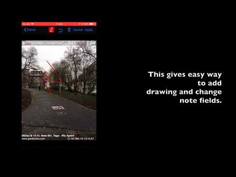
One note on the video — I forgot to mention that you can tap on the camera screen to show the focus square, plus you can change the exposure by moving your finger up/down on the camera screen, of course.
Troubleshooting
- Compass readings are odd — they stay at North and then jump to South
- Where is that stamp on the photo?
- My Bluetooth remote no longer takes photos
- Location accuracy is low — what can I do?
- How do I delete a whole collection of photo-points?
If the camera ever goes overexposed, tap anywhere on the camera screen to recalculate the exposure.
You can always reach us at geocamera@blocoware.com . If there is no reply within 24 hours, please check your spam folder since we reply to every support email. Our phone number is +420 724 730 447 (also Whatsapp and iMessage), but we’d prefer you contact us via MENU > FEEDBACK & SUPPORT > “There is a problem”, as the support email will then contain information on your device model and iOS version.
PRO PACK upgrade
You can do a lot with the basic functions in the app. Here is what the PRO PACK one-time purchase adds on top of it:
- Removes the basic version watermark and allows you to apply a custom watermark with your image, text, and colors .
- Adds the ability to create additional point/image collections.
- Enables sharing of more than 5 points/images at once.
- Adds export/import capabilities. In particular, KMZ export/import enables you to transfer collections or selected waypoints between devices.
- Enables batch import of multiple photos from the photo library.
- Adds the ability to save hand-drawn annotations for the image.
- Options to lock access to the app with PIN code and biometrics
You can always restore this purchase on a different device with the same Apple ID.
More information on PRO pack upgrade
Privacy and terms
Privacy policy ▪︎ Terms of use
Additional contacts
You can also visit our Facebook page at fb.me/cameragps55
Or send messages to our Facebook page at m.me/cameragps55
Reddit: u/blocoware
More apps from us
Land navigation and compass app

GPS Team 55 - Team tracking and collaboration.

Docs ▪︎ Free in AppStore ▪︎ Public beta version (free) .
Speedometer 55 PRO. Mileage and speed tracker.
Planimeter 55. Measure area, perimeter, distance.
Professional GPS taximeter

History of recent releases
Version 5.2 — Video recording, with location data built in
Video recording, with location data built in . Video recording arrives: document inspections, surveys, and sites with video that keeps its location data attached — with data overlays you choose. Plus point map snapshots and low-light photo capture. Everything in 5.2 →
Version 5.1 — Adds Text, Dimension, double-arrow, fill color, and transparency tools for photo markup you can edit later
- Adds Text, Dimension, double-arrow, fill color, and transparency tools for photo markup.
- New annotations are stored separately from the image, so you can select, restyle, edit text, or delete them later.
- KMZ export can include original images with annotation metadata plus presentation-ready images with annotations embedded.
- The camera viewfinder now warns when the detected address is stale or lookup failed.
Version 5.0 — Move deleted photos and points to Trash so mistakes can be recovered
- Adds recoverable, auto-purged Move to Trash for deleted photos and points.
- Helps prevent accidental loss while keeping old deleted items cleaned up automatically.
- Includes many smaller workflow refinements across photo and point management.
Version 4.7 — Export or restore whole photo/point collections as KMZ instead of handling one collection at a time
- Export multiple point/photo collections at once as a single KMZ file.
- Enable or disable several collections in one selection workflow, so only project-relevant photos stay visible.
- Import KMZ archives that contain multiple KML files and nested folders.
- Multi-collection KMZ export is compatible with Google Earth desktop and preserves the data for backup/restore.
Version 4.6 — Mark defects, directions, and areas of interest directly on field photos
- Adds Drawing Tools : Arrow, Circle, Rectangle, and Cross Pointer.
- Keeps freehand drawing and adds line-width control for all drawing tools.
- Useful for marking defects, dimensions, directions, and areas of interest before sharing reports.
Version 4.5 — Crop, rotate, import point files, and restore settings faster during field setup
- Adds Crop, Resize, Tilt, and Rotate next to the Stamp button.
- Makes location and notes overlay size customizable in Settings.
- Restores saved settings directly in the app for quicker job setup.
- Imports point files directly in-app: KMZ, KML, GPX, CSV, and TXT.
Version 4.4 and 4.4.1 — Automate capture workflows with Shortcuts and keep magnetic directions current
- Introduces external control and automation through Siri or the Shortcuts app .
- Version 4.4.1 updates the World Magnetic Model for 2025-2029.
- The updated model improves true/magnetic direction conversion when importing photos or points that provide only one direction type.
Version 4.2 — Paste coordinates and convert OSGB or SK 42 systems without leaving the app
- Adds the text-input based Coordinates Converter .
- Supports OSGB and SK 42 as part of the continuing EPSG coordinate system coverage work.
Version 4.1 — Tune button colors so camera controls stay visible in bright sunlight
- Adds custom button colors for better visibility in bright sunlight.
- Can help adapt the camera UI for different lighting conditions and color-vision needs.
Version 4.0 — Generate useful photo file names and QR links that open navigation
- Adds custom file name patterns for saved, exported, and shared photo files.
- Adds Waze and Yandex navigation links as options for photo QR codes.