Offline maps, overzoom and underzoom.
Allows you to show the map for the zoom levels that are not present in the imported map or the downloaded offline map.
Can be useful when the map provider/server only provides limited zoom levels to download, e.g. 2-14, but you need to operate with the zoom levels of 15-19. Often providers discourage download of anything above level 16.
There are also situations when you can have a map with tiles for only one zoom level. This often happens when you translate vector GeoPDF to a raster map as mbtiles. You’d get a map with zoom level 8 and this is really limiting, unless you can do overzoom and underzoom.
Here is an example of one such translation from GeoPDF to raster mbtiles*, only zoom level 8 is present in the translated mbtiles:
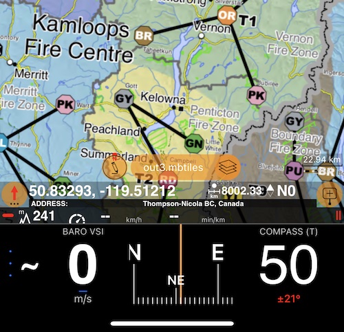
As you can see, it is approximately 23km per centimeter on a map. Without overzoom or underzoom, you’d see nothing on the map if you zoom in or out.
With overzoom, you’ll see a little bit pixelated, but still usable map. Here is the same map, for zoom 11:
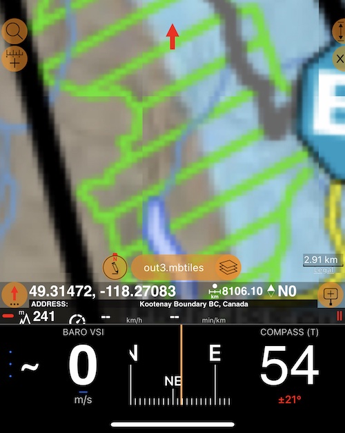
About 3km per map centimeter, a big difference.
For underzoom. Here is zoom level 5:
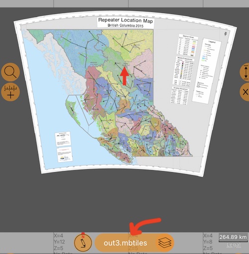
Still better than having blank tiles? The arrow in the above image is to remind you that you can tap here when the map is not in the centering mode and focus on the map area, if you are asking yourself “where is the map” :)
With overzoom capabilities you can now decide voluntarily to download faster/fewer tiles from the map servers, with the conscious trade-off for some pixelation on higher, undownloaded zoom levels. That’s exactly higher zoom levels (17-19) that represent the biggest performance challenge to the map servers. Be a good citizen.
Still, when selecting zoom levels for download, check that they have the detail you need. E.g. smaller street names might be missing on lower zoom levels, overzoom is not going to fix this.
* Translating GeoPDF pdf file to mbtiles is as easy as this:
gdal_translate geopdf.pdf map.mbtiles
You can Google “install gdal on mac” to see how to install gdal, it’s really easy.