Common map settings
Accessing the screen.
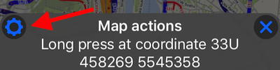
The most direct way to access common map settings screen is by holding finger on a map until “long press” menu appears and tap on its top/left settings button:
For other ways to access this screen, read here .
What can be configured?
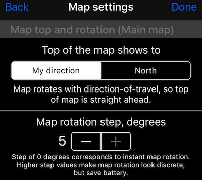
Top of the map pointing North or direction of travel (North Up or Track Up).
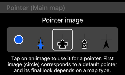
Pointer customization.
New to the common map settings is a “Pointer” section that allows you to pick from 5 pointer types for the main map.
Optional “course line” on a main map.
You can configure either to show the course line on a map or not and if YES, configure its length.
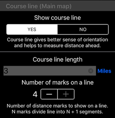
Distance unit to the right of course length is a button allowing you to pick the required distance unit.
Here is how course line looks on a map:
Waypoints handling on a main or secondary maps.
Allows to show or hide waypoints on a main or secondary maps and disable waypoints grouping (which is on by default):
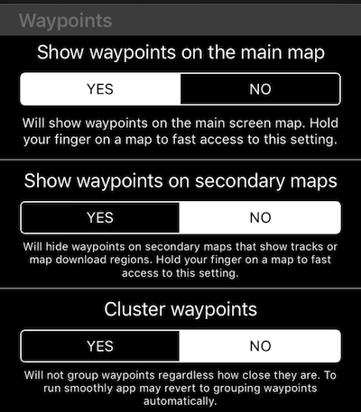
Note that app can switch waypoints grouping to be enabled if it thinks that performance would be bad otherwise.
Option to pin a track to the main map.
Pinned track will be shown on all maps (except the track viewer map) in cyan/host color so you can re-trace your track in forward or backward directions.
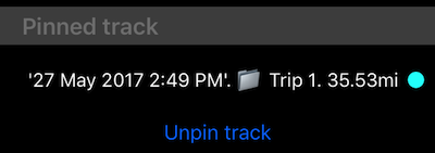
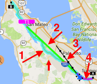
Here is how pinned track looks on the main map (arrow #1, A/B are start and end points of a pinned track):
Annotations — route and polygon connection points.
At the bottom of the common map settings there is an “Annotations” section. It lets you show the connection points of routes and polygons as small dots on the map:
To enable, open map settings > common settings and scroll to the bottom to the “Annotations” section.
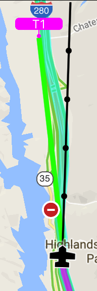
To explain other map elements influenced by map settings:
#2 is a line to a waypoint or location set as a navigation target. You show/hide it by long press on a map and then selecting “show/hide” for the target line. You can also just cancel/stop navigation and line will go away.
#3 is a course line. Can be shown/hidden via common map settings or again, via long press on a map and then show/hide.
#4 is your “location tail”, showing your recent path for better orientation.
T1 is a waypoint. You can set waypoints being shown or hidden on the main or secondary maps in the common map settings or again by “long press” on a map to invoke the show/hide options.
This is it for the map common settings. Here are more links on a map subject:
Blank map. Avoid using internet/data.
Compass 55. Working with a map
Grid shows instead of an offline map, help!
Night and “local roads” styles for the Google map from version 1.1.