Map + stats track view option
Shows track on a map plus detailed statistics on the track:
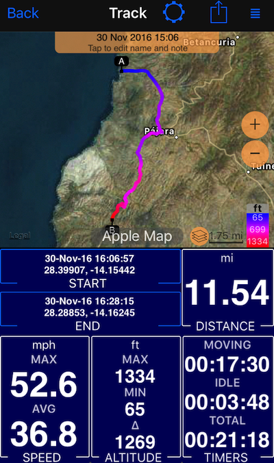
- Settings button on top of the screen allow to switch between different track views
- Action button on top allows to share the track in many different ways. We encourage you to try sharing as a “track image”, we tried to create a “postcard” sharing experience for this. Should be looking lovely when sharing via email, Facebook, etc.
- Grid button top-right allows to either move the track to a different trip or pin it to the main map so you can retrace it.
- START and END in the track view are buttons that allow you to copy start and end coordinates to a clipboard or create a waypoint.
Related information:
Tracks colored by speed or altitude.
All track view options: “Map + speed and altitude chart” track view option ▪︎ “Map + stats” track view option ▪︎ “Map + cost” track view option ▪︎ “Map only” track view option.