Ruler: how far is it from here to there?
How far is it across the park, how long is that fence line, and how much does the ground rise? The ruler answers on the map: tap a point and read the distance, the bearing and the climb, keep tapping for the next leg, follow the paths and roads if you like, and slide along the elevation profile. Nothing is saved until you choose to keep it, so it’s quick for a measurement you only need to look at.
Open the ruler
Tap the Add measurement button and choose Ruler A→B. A sits on the red arrow in the middle of the map, and the bar asks you to tap the map for B.
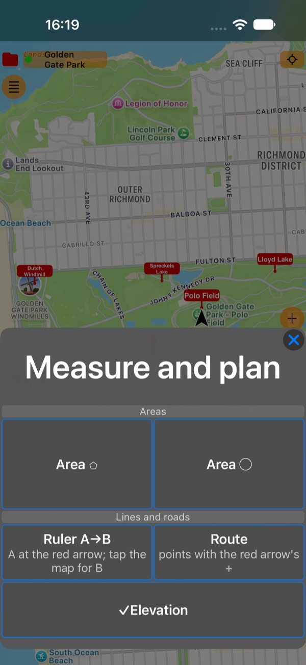
The same menu starts an area or a route that you build point by point and save.
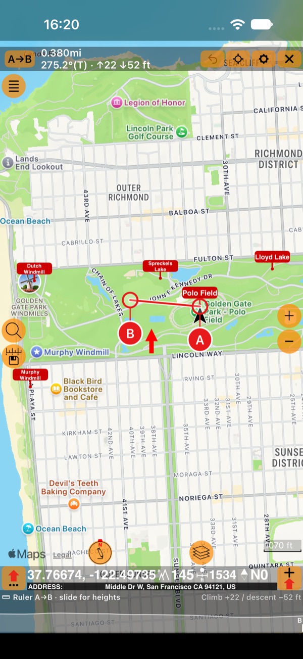
Read the bar
The ruler’s bar replaces the collection’s bar at the top of the map while the ruler is open:
- A→B: the points, from the first to the last. Tap it for the ruler’s menu;
- the distance, the bearing from A to B (with T for true or M for magnetic north), and the climb ↑ and descent ↓ along the line;
- ↶ undoes the last change to the points: a point added, moved or removed. It shows while there’s one to undo;
- the aim button opens Map focus ( below );
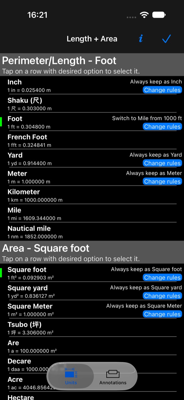
- ⚙ opens the length and area units, with when each unit switches to a bigger one;
- × closes the ruler.
With ✓Elevation on (in the ruler’s menu or the Measure and plan menu), the elevation band under the map shows the line’s profile.
Move a point and snap it
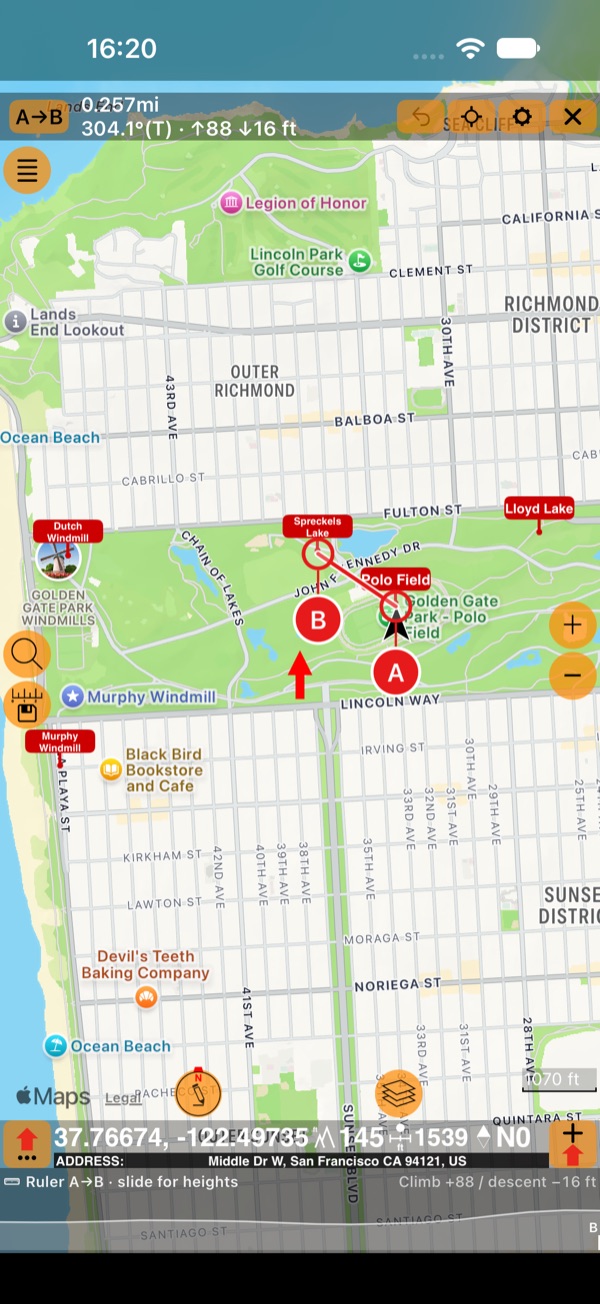
Drag a point by its grip, the lettered circle under it: the grip hangs below the point so your finger never hides the spot you aim at. Drop a point near a point of your collection and it snaps exactly onto it, with a light tick. A point you tap while the ruler is open does the same.
Measure leg by leg
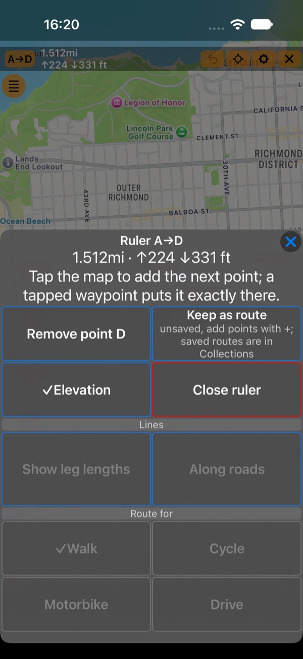
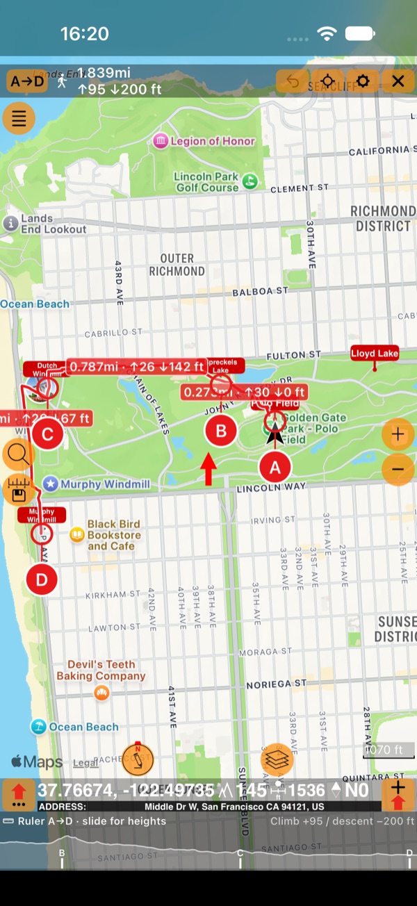
Every tap on the map adds the next point: C, D, and so on. Turn on Show leg lengths in the ruler’s menu to see each leg’s length and bearing on the map, and the bar adds up the whole way.
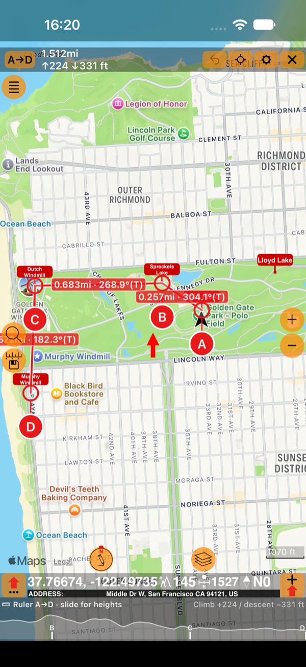
The ruler’s menu (tap A→D):
Along roads
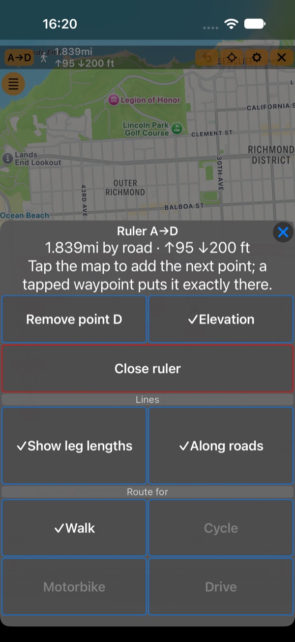
You don’t always cross land in a straight line. Turn on Along roads in the ruler’s menu and choose how you travel in Route for: Walk, Cycle, Motorbike or Drive (Walk at first). Each leg follows the paths and roads open to that activity, the bar reads the distance by road, and each leg shows its own length, climb and descent. A leg with no path or road for the activity is drawn dashed and straight, and the bar says how many legs have no road.
The roads are for measuring. While Along roads is on, the ruler’s menu has no Keep as route: a route keeps the points and draws straight lines between them, not the roads you just measured.
Slide along the profile
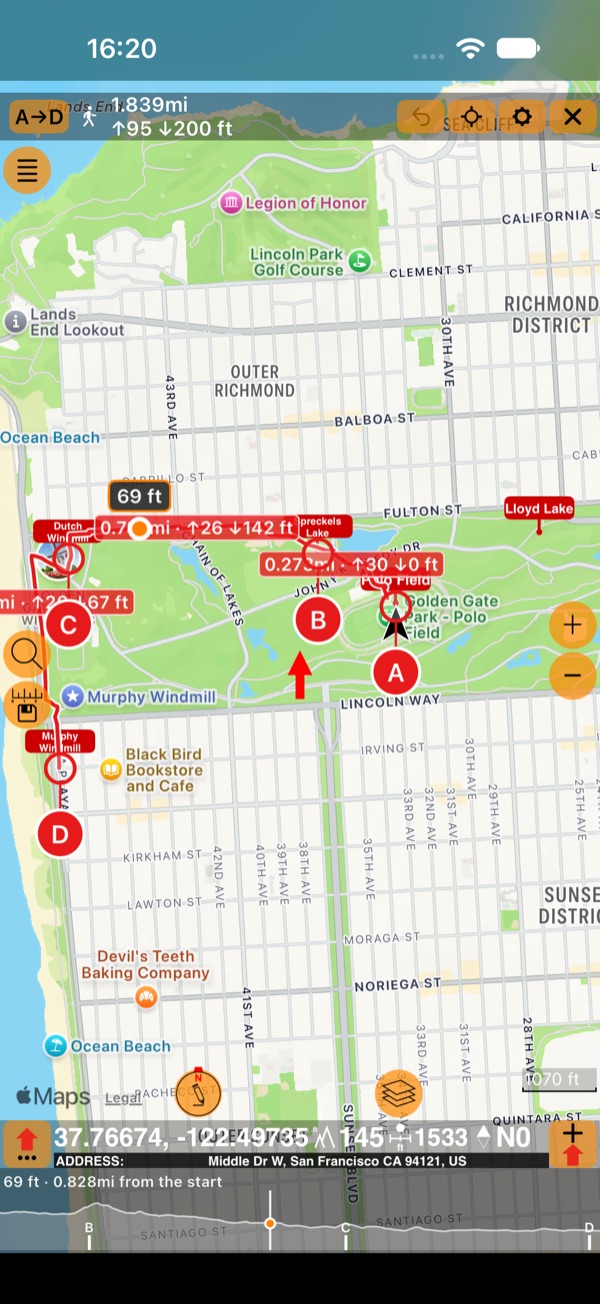
Slide a finger along the elevation band: it reads the height and the distance from the start, a dot follows on the map, and each point has its tick on the profile. Lift your finger and the reading stays for a moment.
Each point’s menu
Tap a point’s grip (a drag still moves it) for its own menu: its coordinates, its height, and the way to it from the point before.
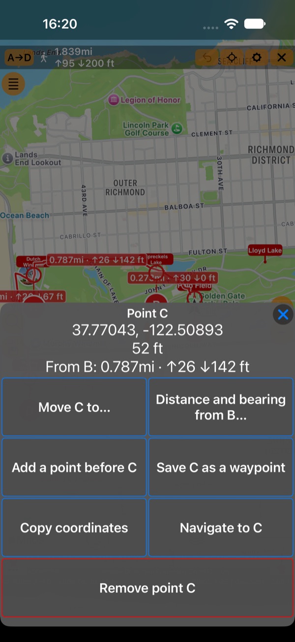
- Move C to… searches for a place, a point of your collections or coordinates and moves the point there.
- Distance and bearing from B… places the point at a distance and bearing you type.
- Add a point before C adds one midway on the leg.
- Save C as a waypoint in the collection on the map, or Copy coordinates.
- Navigate to C makes it your navigation target.
- Remove point C. Points can go down to A alone.
See it all
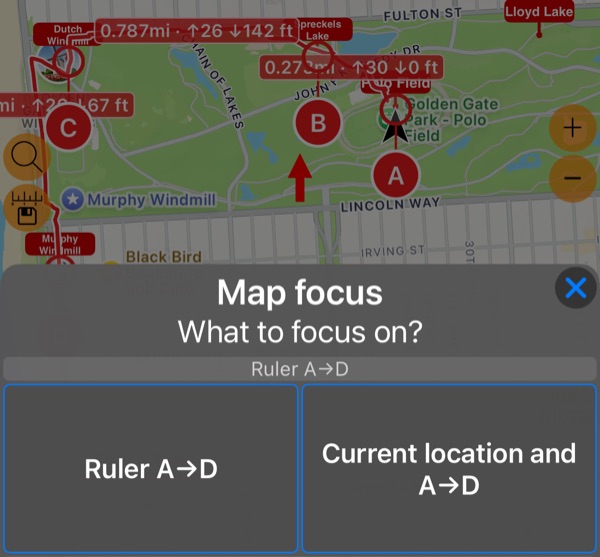
Tap the aim button in the ruler’s bar (Map focus) and choose Ruler A→D to fit the whole line on the screen, or Current location and A→D to see where you are.
Keep it
Keep as route (straight lines) turns the ruler’s points into a route, not yet saved: add points with the Add point button and save it to a collection , like any measurement.
Units
Lengths, bearings and heights follow your length and area units and the compass settings (degrees or mils, true or magnetic north). ⚙ in the ruler’s bar opens the units, and each one’s rule says when it switches to a bigger unit, for example from feet to miles above 1,000 ft.
Good to know
- The ruler stays where you left it when you switch between Apple and Google maps, and after a restart.
- One thing at a time: while the ruler is open, the Add measurement button opens the ruler’s menu and shows a red dot.
- Along roads finds its roads with our own router on OpenStreetMap data, so it needs an internet connection.