Version 5.3 - What's new?
Version 5.3 is mostly about the camera screen. Autofocus, the lens, the light and the moment of capture used to be the app’s decisions; in 5.3 they are yours, without taking a single option away from anyone who never opens these menus. The point editor gets the same treatment for the values it stores, and video mode learns two new jobs: writing down what was said, and handing the data overlays over to your video editor as separate layers.
Focus that stays where you put it
Behind a windscreen, autofocus hunts between the glass and the road. On a shelf you photograph every week it settles a little differently each time. Neither is a setting problem — it is autofocus doing its job on the wrong subject.
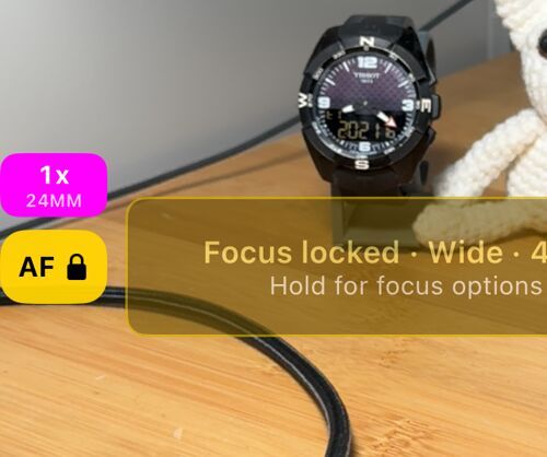
The AF button is now always on the viewfinder. A tap locks focus where it is; exposure keeps adjusting, so a tunnel or a low sun still gives you a usable frame. Hold it and you get the rest:
- Save current focus stores the distance you are on, per lens. Lock at saved focus returns to it on any later visit, so the shelf, the gate or the meter is framed the same way every time.
- Set focus by hand opens a dial: slide it, watch the picture, and stop where you want. For the shot autofocus will never agree with.
- Focus at start does any of it automatically the moment the camera opens.
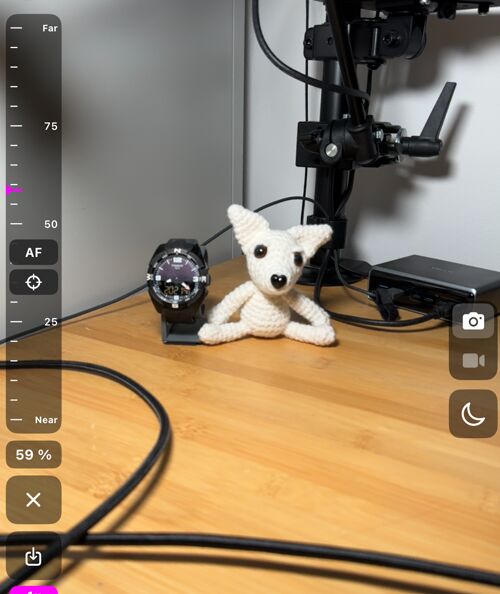
Everything about focus, on one page.
Every lens of your iPhone, by name
An iPhone with several cameras normally hides them behind one zoom slider. That is right for snapshots and wrong for a survey, where two photos of the same wall should be taken through the same glass at the same framing.
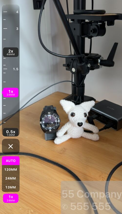
- The lens strip puts every lens stop on a dial you can drag or tap, and a lens selector underneath: AUTO, or one focal length. Pick a focal length and the picture never changes lens on its own again.
- The zoom chip always names the lens actually doing the work — so you can see when iOS has quietly served a close-up from the ultra-wide instead of the lens you expected.
- A single selected lens now zooms to its sensor’s maximum, with the dial dimmed past the point where iOS stops recommending it, so you always know where the sharp range ended.
- Every lens and the whole zoom range are free. Only remembering the lens and zoom you used last is part of PRO.
A few seconds between the tap and the shot
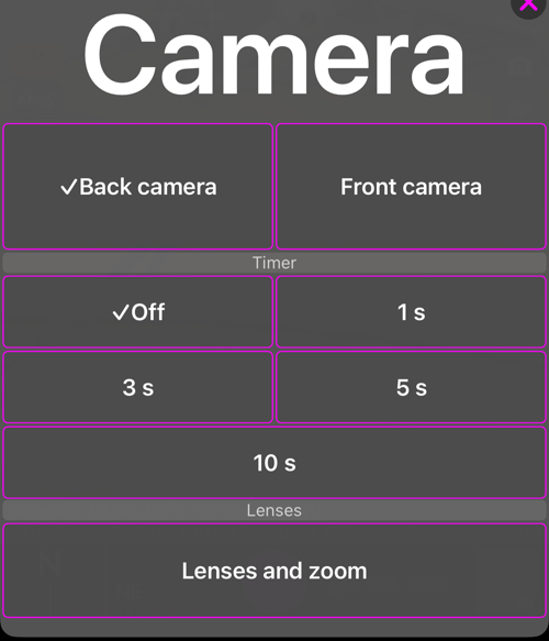
A finger on the screen moves the phone, and on a pole, a mast or a tripod that is exactly the shake you were trying to avoid. The camera button at the top of the screen now opens a sheet with a shutter timer — 1, 3, 5 or 10 seconds — alongside the front and back cameras. A ring counts down around the shutter and a second tap cancels it. Starting a video recording counts down too; stopping never waits, and neither does the Apple Watch, a Bluetooth remote or the hardware buttons, which are already shake-free.
Start recording without touching the phone
A phone on a helmet, on a pole or in a windscreen mount is exactly where you cannot reach the record button — and reaching for it is what ruins the first seconds of the clip.
Start video recording and Stop video recording are now Siri and Shortcuts commands. Say “Start video recording in GPS Camera” and the app comes forward, opens the camera in video mode and starts recording, from a cold launch if that is where you were. Put them in an automation, on Back Tap or on the Action button and there is no voice involved at all.
Siri often leaves its own reply on the screen after it has spoken, and the recording waits for that to go: tell Siri to dismiss itself — “Dismiss yourself” — or tap the screen, and the recording starts.
Stopping is the honest half. Video is recorded in the foreground only — the app saves the recording the moment it goes to the background — so Stop video recording reaches a recording while the camera is still on screen, and anywhere else there is nothing left to stop, because the file was already saved.
Two limits worth knowing before you plan around it. A command spoken to Siri may leave the microphone with Siri, in which case the recording it starts has no sound — run the shortcut without speaking when the audio matters. And if you protect the app with a PIN, it re-locks every time it leaves the screen, so a command from outside cannot get past the lock: hands-free recording then needs the app already open and unlocked.
More on the Siri and Shortcuts commands.
A viewfinder set up for the job
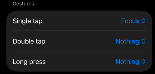
Every option here is off by default — a camera you never configure behaves exactly as it did before.
- Assign Single tap, Double tap and Long press to focus, the shutter, a focus lock or a black screen. Useful with gloves, or with the phone in a mount you cannot comfortably reach.
- The black screen keeps recording with the display dark, for a long recording from a windscreen at night or anywhere the phone must not light up. A double tap brings the viewfinder back.
- The AF and microphone buttons can be set so a tap only reports the state and every change lives in the hold menu — a stray touch while driving then changes nothing.
A light that stays on while you record
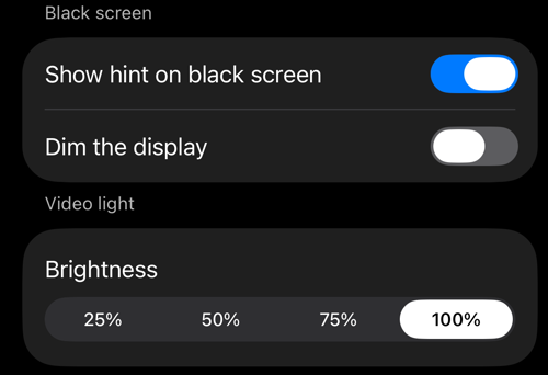
A photo flash fires once. A crawl space, a riser, a plant room or a roadside at night needs light for the whole recording, not for one frame.
In video mode the flash button is now a video light — a continuous light you switch on and off with the same button, shown with a flashlight icon and completely separate from the photo flash. Settings > Viewfinder controls > Brightness sets its level from 25 % to 100 %, so a close-up of a label is not blown out and a dark room still gets everything the phone can give.
It behaves the way a work light should: it survives a lens change and an interruption and comes back on afterwards, and it goes out while the black screen is on. If iOS turns the light off because the phone has got too warm, the app tells you, and switches it back on as soon as it is allowed to.
More on the video light and the rest of the viewfinder.
Every point value, and where it came from
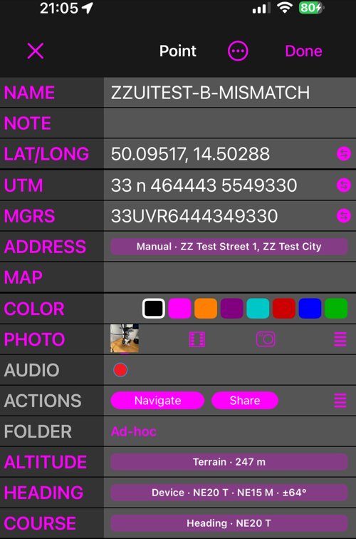
The point editor now has two views. Simple is the familiar compact editor and stays the default. Advanced shows where each value came from — the GPS, the terrain, what you typed, the photo itself — and lets you pick the one you trust for altitude, address, heading and course, or type one in yourself, which the editor could not do before. Nothing changes until you tap Apply: finding, measuring or reading a photo only ever offers a candidate.
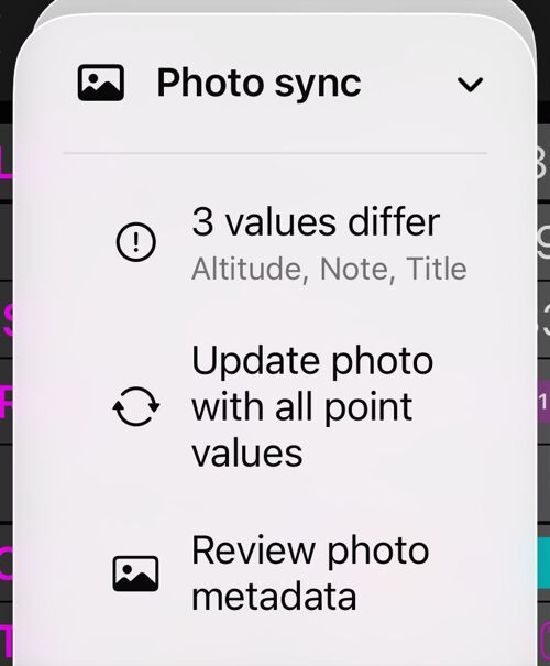
The attached photo is kept in step field by field. Photo sync says how many values differ, and you choose once what Done should do about it — ask, write silently, or leave the photo alone. Clearing a title, note, address or altitude offers to remove it from the photo too, always switched off unless you switch it on yourself.
More on the Advanced point editor. · The point editor.
What you said on camera, as text
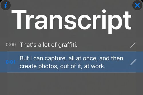
On iOS 26 or later, a recording can be transcribed on the iPhone itself — nothing is uploaded. You get a timestamped line per phrase: tap one to jump to that moment in the video, search the words to find the clip you half remember, edit a line the recogniser misheard, show the lines as captions during replay, and export or import SRT subtitles.
More on video transcripts and captions.
Your gauges over footage from another camera
The inspection was filmed on a GoPro on the helmet, a DJI in the hand, an Insta360 on a pole, or the dashcam. The position, the map and the speed were recorded here. Until now the only way to put them together was to burn the overlays into this app’s picture.
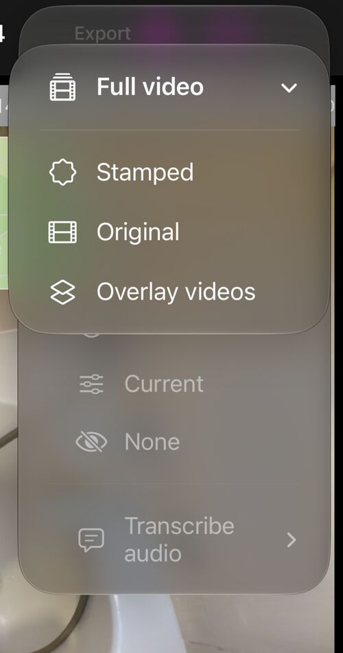
Overlay videos exports the data overlays on their own. Open a saved recording
and choose More > Full video > Overlay videos — or Selected range, if you
have marked one. Every selected overlay becomes its own video file, cropped
to the gauge rather than a full frame, so four overlays give four independent
layers you can place, scale and hide in iMovie, Final Cut Pro, DaVinci Resolve,
Premiere Pro, CapCut or any other editor.
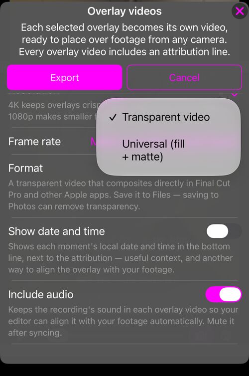
Formatdecides how the transparency travels. Transparent video carries its own alpha channel and drops straight onto a layer in Final Cut Pro, Motion and iMovie — save it to Files, not to Photos. Universal (fill + matte) is a double-height file, picture over mask, for every editor that uses a luma matte. When in doubt, export fill + matte.ResolutionandFrame ratefit the tiles to your timeline;Match recordingnames the rate it will use.Show date and timeprints the moment on the tile, andInclude audiokeeps the recording’s sound inside each file so the editor can line the overlays up against your own footage by itself.
The overlays offered are the ones visible in the recording’s current
presentation, so Historical gives what was saved with the recording and
Current gives today’s layout. Exporting never changes the original recording.
Overlay videos are part of the paid export capability, with the
PRO PACK
upgrade.