Trilhas coloridas por velocidade ou altitude.
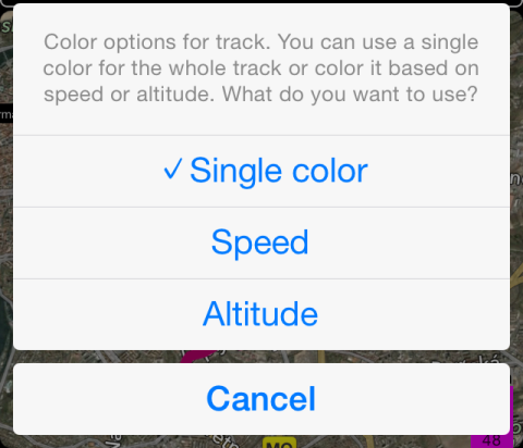
As trilhas gravadas podem ser exibidas em um mapa coloridas por velocidade ou altitude. Toque em uma caixa violeta com valores de velocidade mínima, média e máxima para abrir as opções de coloração de trilhas.
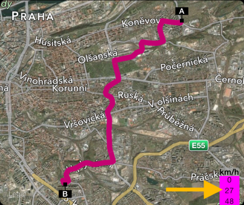
Veja como fica uma trilha colorida por velocidade:

E a mesma trilha, colorida por altitude:

Informações relacionadas:
Como fixar uma trilha em um mapa para rastreá-la mais tarde?