Map user manual
There is also a short video tutorial available for working with maps
Terminology
Live/Main map Map that shows your location and a short pink “tail” for your most recent locations. Waypoint A point on the map that marks some location of interest. With speedometer you can attach photo and audio record to those points. Pinned track A previously recorded GPS track that is shown on a live map in a “ghost” manner, so it is convenient to navigate along it, back or forward.
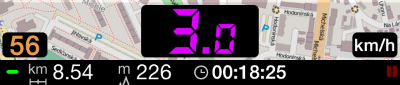
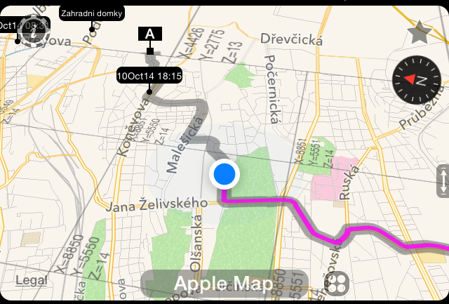
Live map elements
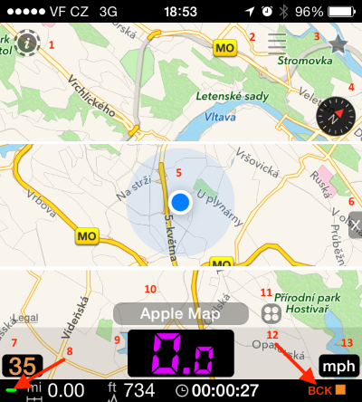
- Speedometer settings button
- Main menu button
- Feedback/Help button
- Compass (only shown on Apple, offline and custom maps)
- User location pointer
- Close full screen mode button
- Currently set speed limit
- GPS accuracy indicator
- Speed digits
- Map name
- Map type and settings button
- Indicators (background mode, tracking, pause, night mode)
- Speed units
Map options
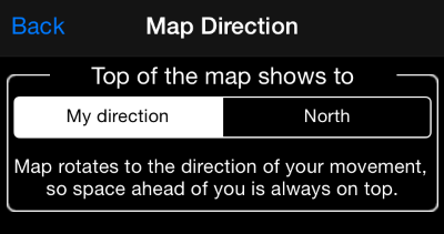
The map can be oriented so its top matches the direction of your movement or to always show to North. Tap on button #11 and then on the “Common settings” button:
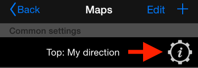
to configure your “map top” preference:
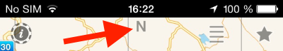
Letter “N” on a map top will serve as a reminder in case when the top of the map is set up to always point to North:
Map Types
Tap on button #11 to open the map settings menu. You can either pick from the existing types of map or add your own custom or offline map.
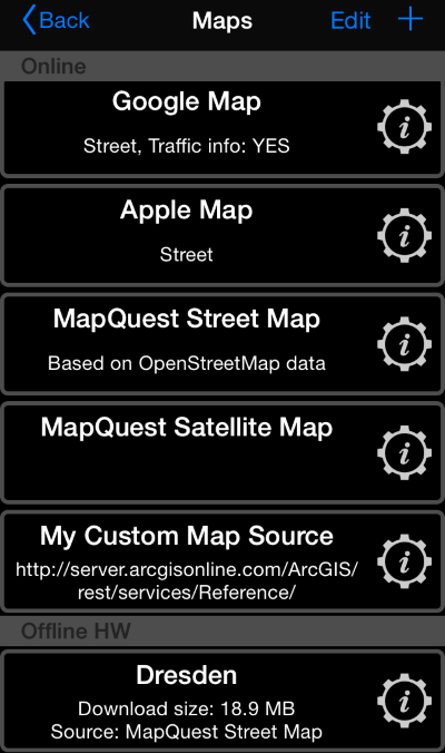
You can read more on managing and using custom maps and managing offline maps .
Map full screen mode
To change the speed limit, swipe left or right on the bottom speed area:
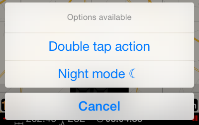
Hold your finger on speed digits until menu double tap and night mode menu opens:
Pin recorded GPS track to a live map
From a track detail view, tap on a “more” button:
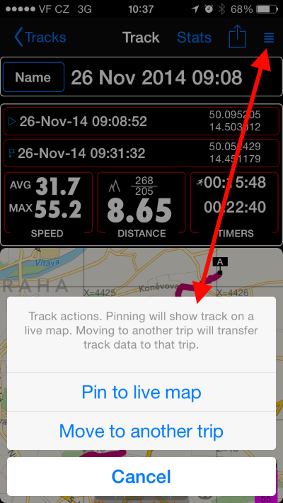
Pick “Pin to live map” and the track will be shown on a live map:
Waypoints on a map
To show or hide waypoints, hold your finger on a map until a menu opens with options to show or hide waypoints.
The map is evolving over time and here are a few links on new capabilities:
Coordinate, distance and heading tools for the “don’t follow me” map mode
Create or edit an off road route on a map. Or import from GPX.
Import existing mbtiles, Rmaps, sqlitedb maps
Color coded waypoints Live/Main map Map that shows your location and a short pink “tail” for your most recent locations. Waypoint A point on the map that marks some location of interest. With speedometer you can attach photo and audio record to those points. Pinned track A recorded previously GPS track that is shown on a live map in a “ghost” manner, so it is convenient to navigate along it, back or forward.